Brigantine NJ “Flood Depth Hazard Maps”
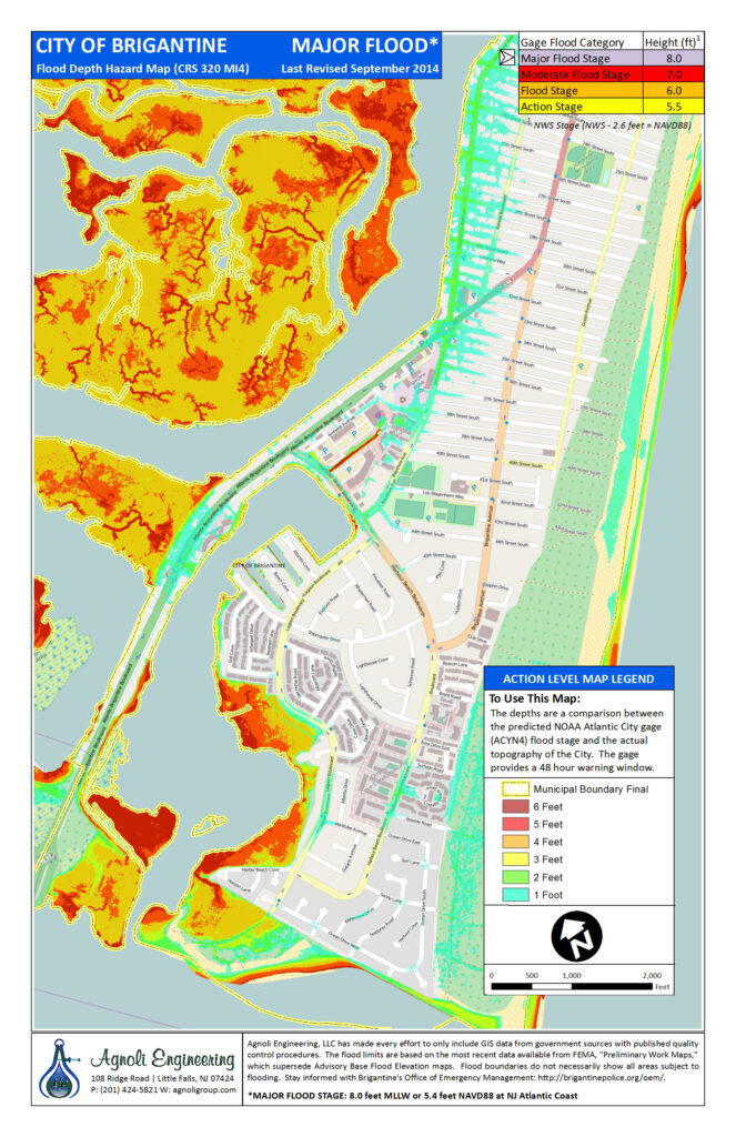
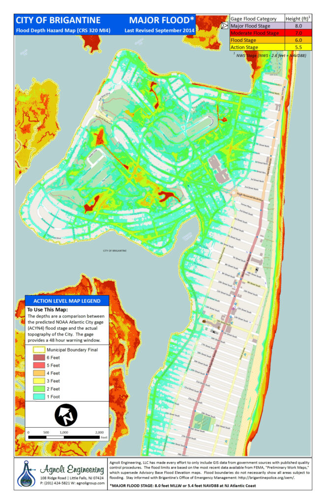
Maps are broken down into 4 parts.
(1) is “Action Level”, where we begin to see effects of flooding and prepare to take action (Ie: flood buster pumps, flood gates).
(2) is “Minor Level”, where we see minor flooding in our low lying areas.
(3) is “Moderate Level”, where more streets that aren’t typically covered get flooding.
(4) is “Major Level”, where flood water reaches depths that begin to damage property and vehicles.
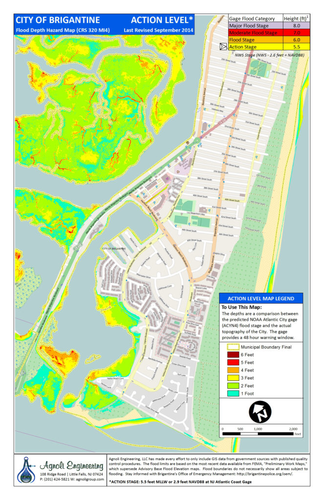
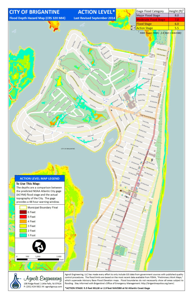
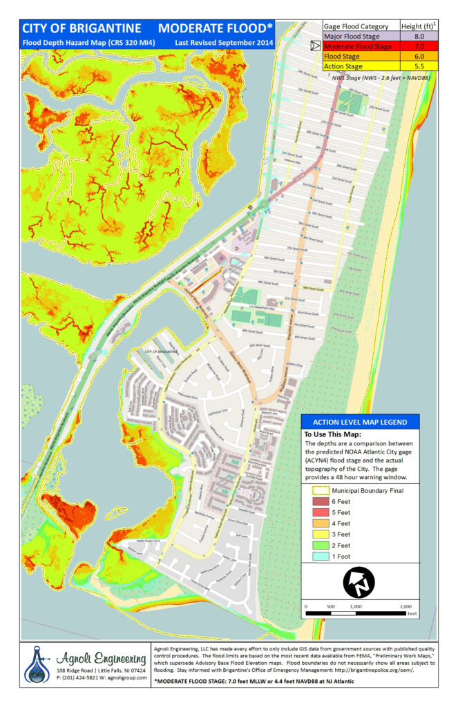
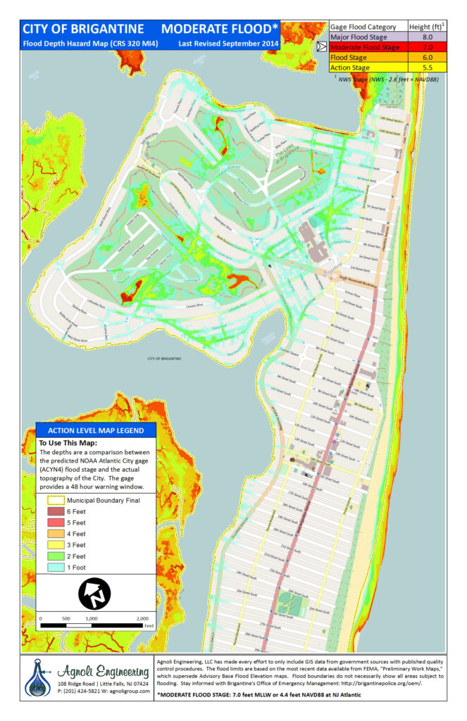
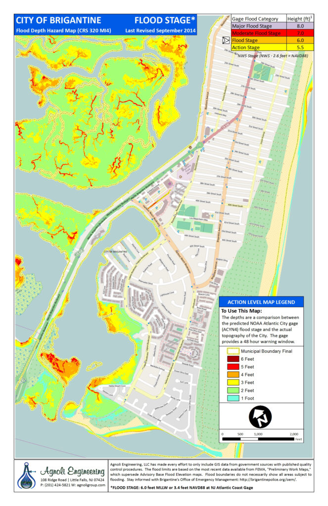
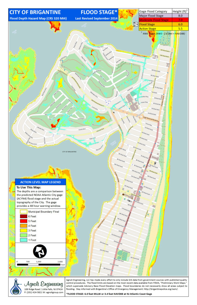
Action level flooding starts at 5.5 Feet
Minor level flooding starts at 6.0 Feet
Moderate level flooding starts at 7.0 Feet
Major level flooding starts at 8.0 Feet
The images are based off the NOAA tidal gauge, located at https://water.weather.gov/ahps2/hydrograph.php?gage=acyn4&wfo=phi


